Within S 4 Claim
Should S 4 Have Shown Up on Maps?
Satellite and aerial imagery are central to whether Lazar's claimed Papoose Lake workplace should have left visible traces.
On this page
- What Lazar's S 4 layout would require on the ground
- What satellite and aerial images appear to show
- Why absence of visible traces matters but does not settle everything
Page outline Jump by section
Introduction
Bob Lazar’s S-4 story depends on more than the existence of Area 51. It depends on a second, highly concealed installation near Papoose Lake that he said housed recovered craft inside mountain-facing hangars. That claim creates a practical question that satellite imagery, aerial photography and terrain analysis can partly test: if such a facility existed, should it leave visible traces?
 Over the past three decades, researchers, sceptics, enthusiasts and amateur satellite analysts have repeatedly examined Papoose Lake using public imagery. The result is striking. Despite increasingly detailed commercial satellite coverage, no clear evidence of Lazar’s described S-4 complex has emerged. There are no obvious hangar entrances, no confirmed support buildings, no visible transport infrastructure and no construction scars matching the scale Lazar’s account appears to require. That absence matters because hidden military projects still usually leave logistical fingerprints. At the same time, imagery alone cannot absolutely rule out deeply buried facilities, temporary structures or locations different from the popularly assumed site. The debate therefore centres less on whether Area 51 was secret — it was — and more on whether Lazar’s specific Papoose Lake workplace ever left a detectable footprint at all. [OtherHand]otherhand.orgOtherHandPapoose – ConMost of the evidence of the existence of a secret facility at Papoose Lake is anecdotal. Tales told by people, whic… [The War Zone]twz.comUnsurprisingly, nothing appears to be there, just as…Read more…
What Lazar’s S-4 layout would require on the ground
Lazar’s description was unusually concrete for a supposedly ultra-secret site. In interviews and sketches, he described a facility built into the hillside near Papoose Lake, with camouflaged hangar doors blending into the terrain. Later retellings and reconstructions often depict several large bays arranged along the mountain edge, supposedly large enough to contain disc-shaped craft. [Metabunk]metabunk.orgs4 the bob lazar story evidence.14825S4: The Bob Lazar Story Evidence?4 Apr 2026 — It seems unlikely; there's no evidence of access roads, taxiways or runways…. The second…
That kind of installation would normally imply more than hidden doors. Even a compartmented underground facility requires practical support systems:
- access roads or graded vehicle tracks;
- spoil piles from excavation;
- ventilation infrastructure;
- electrical and communications links;
- drainage or flood management;
- security perimeters;
- loading areas or maintenance access;
- evidence of regular personnel movement.
Critics of Lazar’s account often focus on this point rather than on the alien claim itself. A large buried aerospace facility is still a large engineering project. The more ambitious the claimed underground complex becomes, the harder it is to conceal all external signs indefinitely from aerial observation. [OtherHand]otherhand.orgOtherHandPapoose – ConMost of the evidence of the existence of a secret facility at Papoose Lake is anecdotal. Tales told by people, whic…
The logistics problem becomes sharper because Lazar’s own descriptions imply routine operational use rather than a tiny bunker. He described transport from Groom Lake by bus, multiple craft bays, laboratory activity and ongoing technical work. That suggests a functioning workplace with recurring staff traffic, maintenance and supply needs, not a dormant emergency shelter.
Some believers counter that the entire point of S-4 was concealment, and that highly classified programmes may deliberately minimise visible infrastructure. Area 51 itself remained officially unacknowledged for decades despite extensive aviation activity nearby. However, Groom Lake still produced unmistakable physical evidence visible from the air: runways, hangars, fuel storage, roads and expanding construction over time. The question is whether a hidden Papoose facility could realistically leave almost nothing comparable behind.
What satellite and aerial images appear to show
Public imagery of the Groom Lake region improved dramatically from the 1990s onwards. Early satellite images were often blurred, outdated or commercially restricted. Modern services, however, provide far clearer views of the Papoose Lake basin and surrounding ridges.
Repeated examinations by Area 51 researchers and online communities have failed to produce consensus evidence of Lazar’s described installation. [Reddit]reddit.comvisible structure at s4RedditVisible structure at S4?: r/area51November 14, 2006 is the first time Papoose Lake shows up with modern day satellite imagery. Be… [Metabunk]metabunk.orgdebunking bob lazars drawing of s 4 hangers.9839MetabunkDebunking Bob Lazar's drawing of S-4 hangers7 Jul 2018 — The doors Bob Lazar described and drew were not in the middle of the han…
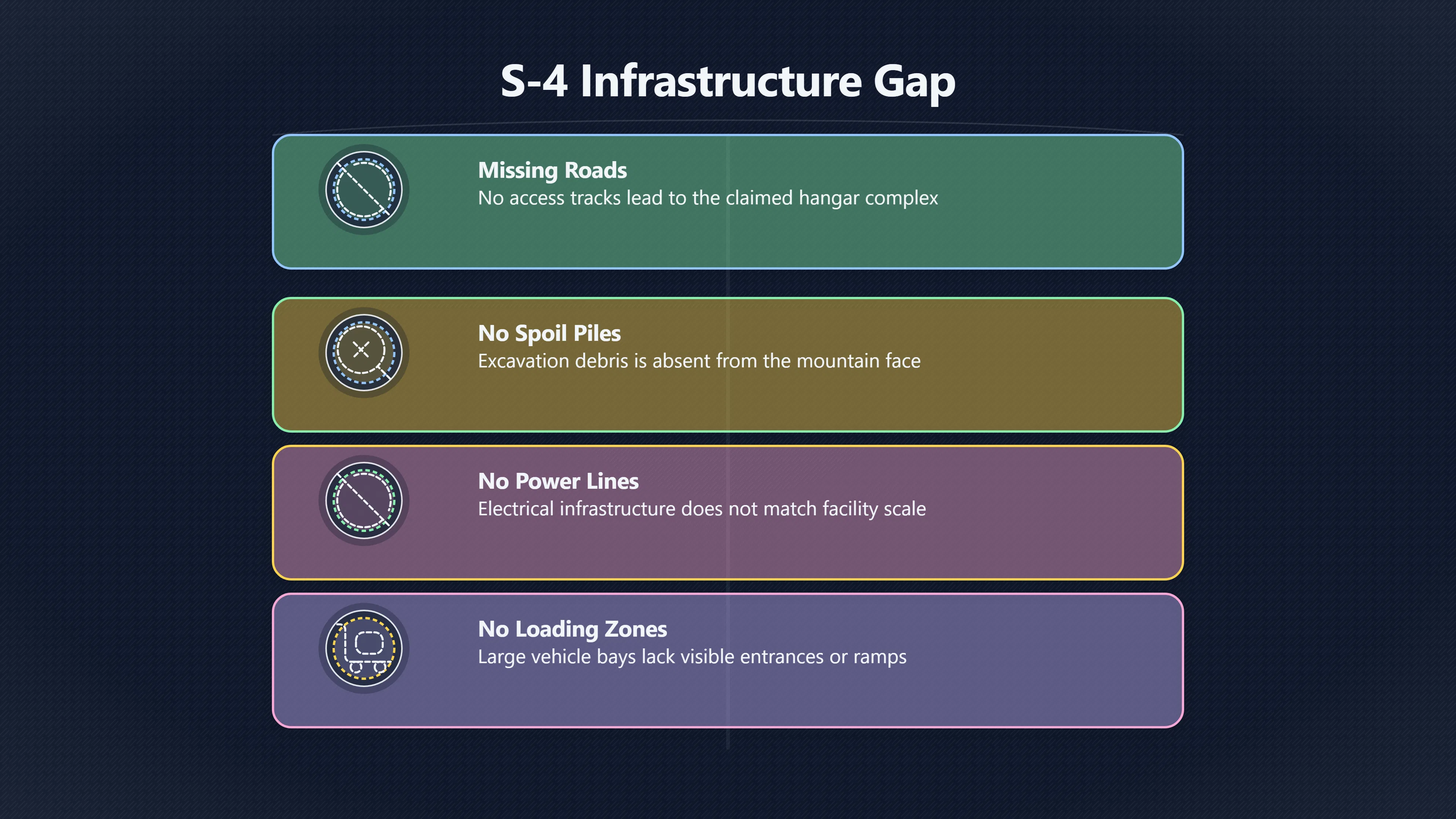
The main problem: missing infrastructure
The most commonly cited issue is the lack of obvious support infrastructure around the eastern side of Papoose Lake, where Lazar’s S-4 is usually placed.
Researchers analysing Google Earth imagery and aerial photographs have repeatedly noted:
- no confirmed road system leading to a large concealed hangar complex;
- no loading zones or visible entrances of the scale described;
- no large spoil fields consistent with excavation;
- no clear power distribution patterns;
- no persistent construction disturbance.
One detailed sceptical analysis argued that if the hangar line Lazar described were real, the mountain face would likely show major engineering modification visible in terrain shading and seasonal imagery. [OtherHand]otherhand.orgOtherHandPapoose – ConMost of the evidence of the existence of a secret facility at Papoose Lake is anecdotal. Tales told by people, whic…
The lack of roads is especially important because Lazar said personnel travelled there regularly by bus from Groom Lake. Public imagery does show tracks and dirt routes elsewhere within the Nevada Test and Training Range, but nothing universally accepted as an access route to a substantial concealed installation at the popularly identified Papoose location. [The War Zone]twz.comUnsurprisingly, nothing appears to be there, just as…Read more…

Terrain and flooding issues
Aerial photography also highlights environmental problems for the classic S-4 interpretation.
Papoose Lake is a dry lakebed that periodically floods. Aviation and military analysts have pointed out that parts of the basin can become muddy or waterlogged, complicating the notion of heavy routine transport directly across the lake floor. [The War Zone]twz.comUnsurprisingly, nothing appears to be there, just as…Read more…
That does not make underground construction impossible, but it raises additional engineering questions. A deeply buried complex near a periodically wet playa environment would require drainage and stabilisation work that might itself become visible from the air.
Claims of “anomalies” in imagery
Supporters occasionally point to shadows, terrain lines or apparent geometric patterns on satellite imagery as possible signs of hidden doors or covered structures. Online forums and documentaries frequently circulate annotated images claiming to show outlines matching Lazar’s sketches. [Reddit]reddit.comRedditImage of S4 map from Bob Lazar Doc + superimposedThe map of unknown origin seems to imply the mountain grouping east of Papoose Lak…
The problem is that these interpretations rarely survive detailed scrutiny. Many alleged “doors” disappear under different lighting conditions, seasonal changes or improved image resolution. Others appear consistent with natural erosion patterns, image compression artefacts or ordinary geological formations.
This does not conclusively disprove Lazar’s claim, but it weakens arguments that satellite imagery positively confirms S-4. After decades of examination, no widely accepted image has emerged showing an unmistakable hidden hangar system at Papoose Lake.
Why the missing footprint matters
The absence of a visible S-4 footprint is not merely a technical objection. It directly affects Lazar’s credibility because his story is unusually specific and physically testable.
If Lazar had described only rumours, brief sightings or inaccessible underground chambers at an unknown location, the claim would be harder to assess externally. Instead, he described a repeat-workplace environment with transport routes, mountain hangars and ongoing operations. That creates expectations about what the landscape should reveal over time.
Sceptics therefore argue that the imagery problem is cumulative:
- no verified construction records;
- no confirmed support infrastructure;
- no independently identified entrance system;
- no corroborated transport route;
- no consistent physical trace matching the described scale.
Taken together, they see this as evidence against the existence of Lazar’s S-4 as commonly described. [OtherHand]otherhand.orgOtherHandPapoose – ConMost of the evidence of the existence of a secret facility at Papoose Lake is anecdotal. Tales told by people, whic… [The War Zone]twz.comUnsurprisingly, nothing appears to be there, just as…Read more…
The issue also matters because real secret military programmes have repeatedly become visible in indirect ways even before official acknowledgement. Groom Lake itself eventually became identifiable through runways, aircraft sightings, worker transport patterns and expanding facilities long before the CIA formally acknowledged Area 51. [Wikipedia]WikipediaBob LazarA self-proclaimed physicist, Lazar supposedly worked at a secret site near the United States Air Force facility popularly kno…
In that sense, the comparison cuts against Lazar. The broader Area 51 environment produced accumulating physical evidence over time. S-4 has not done so to the same degree.

Why imagery alone does not completely settle the question
Even critics of Lazar generally acknowledge that satellite imagery has limits.
A buried facility with minimal surface exposure could theoretically evade casual observation. Governments also classify and obscure sensitive sites in various ways. Historically, some military locations appeared with degraded or outdated imagery in commercial mapping systems. [Live Science]livescience.com63943 secret military base google maps mysteryLive ScienceMilitary Mystery Solved: Two Guys Out-Googled…26 Oct 2018 — Satellite imagery of an experimental military base that was mi…
There is also uncertainty around the exact location. Later reconstructions of S-4 often rely partly on inference rather than on Lazar publicly identifying precise coordinates from the beginning. If the commonly assumed eastern Papoose Lake site were wrong, imagery analysis of that specific hillside could miss the intended location altogether. [OtherHand]otherhand.orgOtherHandPapoose – ConMost of the evidence of the existence of a secret facility at Papoose Lake is anecdotal. Tales told by people, whic…
Another complication is that “S-4” itself is not necessarily unique terminology. Some confusion exists between Lazar’s alleged alien reverse-engineering facility and unrelated military or radar-testing locations elsewhere in Nevada that have used similar naming conventions. This has sometimes muddied online discussions and led to mistaken claims that Lazar’s S-4 was “confirmed” when the identified site was actually something else entirely. [FighterControl]fightercontrol.co.ukFighter Control Area 51FighterControlArea 51 - FighterControl17 Aug 2013 — I know that some guys have deeply analysed Papoose Lake from satellite pictures… B…
Still, these caveats mainly preserve theoretical possibility rather than providing affirmative support. The core issue remains that increasingly detailed public imagery has not produced strong independent confirmation of the specific hillside complex Lazar described.
The broader credibility impact
The Papoose Lake imagery debate illustrates a recurring pattern in assessments of Bob Lazar. Parts of the broader setting are unquestionably real: the Nevada Test and Training Range, extreme secrecy around Groom Lake, classified aerospace work and long-standing compartmented programmes. Those realities make Lazar’s story feel superficially plausible to many readers.
But when attention narrows from the general atmosphere of secrecy to the specific physical claims, the evidence becomes thinner.
The missing S-4 footprint does not conclusively prove Lazar fabricated the story. A hidden underground installation is difficult to rule out with absolute certainty. However, decades of aerial photography, commercial satellite imaging and terrain analysis have failed to reveal the kind of external evidence many researchers expected if Lazar’s account were substantially accurate.
That gap between dramatic claim and missing physical trace remains one of the strongest unresolved weaknesses in the S-4 narrative.
Amazon book picks
Further Reading
Books and field guides related to Should S 4 Have Shown Up on Maps?. Use these as the next step if you want deeper reading beyond the article.
Skunk Works
Provides realistic context for hidden facilities and classified development.
eBay marketplace picks
Marketplace Samples
Example marketplace items related to this page. Use the search link to explore similar finds on eBay.


Endnotes
-
Source: otherhand.org
Link: https://otherhand.org/home-page/area-51-and-other-strange-places/bluefire-main/bluefire/the-papoose-lake-primer/papoose-con/Source snippet
OtherHandPapoose – ConMost of the evidence of the existence of a secret facility at Papoose Lake is anecdotal. Tales told by people, whic...
-
Source: metabunk.org
Title: s4 the bob lazar story evidence.14825
Link: https://www.metabunk.org/threads/s4-the-bob-lazar-story-evidence.14825/Source snippet
S4: The Bob Lazar Story Evidence?4 Apr 2026 — It seems unlikely; there's no evidence of access roads, taxiways or runways.... The second...
-
Source: metabunk.org
Title: debunking [bob lazars]({{ ‘did-bob-lazars-story-hold-up/’ | relative_url }}) drawing of s 4 hangers.9839
Link: https://www.metabunk.org/threads/debunking-bob-lazars-drawing-of-s-4-hangers.9839/Source snippet
MetabunkDebunking Bob Lazar's drawing of S-4 hangers7 Jul 2018 — The doors Bob Lazar described and drew were not in the middle of the han...
-
Source: reddit.com
Title: visible structure at s4
Link: https://www.reddit.com/r/area51/comments/1gdmba6/visible_structure_at_s4/Source snippet
RedditVisible structure at S4?: r/area51November 14, 2006 is the first time Papoose Lake shows up with modern day satellite imagery. Be...
Published: November 14, 2006
-
Source: reddit.com
Link: https://www.reddit.com/r/UFOB/comments/1f3z5ov/image_of_s4_map_from_bob_lazar_doc_superimposed/Source snippet
RedditImage of S4 map from Bob Lazar Doc + superimposedThe map of unknown origin seems to imply the mountain grouping east of Papoose Lak...
-
Source: Wikipedia
Link: https://en.wikipedia.org/wiki/Bob_LazarSource snippet
Bob LazarA self-proclaimed physicist, Lazar supposedly worked at a secret site near the United States Air Force facility popularly kno...
-
Source: Wikipedia
Title: Area 51
Link: https://en.wikipedia.org/wiki/Area_51 -
Source: metabunk.org
Link: https://www.metabunk.org/threads/the-lazar-development-did-bob-lazar-borrow-s-4-details-from-1976-scifi-novel.13962/Source snippet
Did Bob Lazar Borrow S-4 Details from 1976 SciFi Novel?26 Jan 2025 — As the scientists set out to probe the area "just southeast of Papoo...
-
Source: Wikipedia
Link: https://en.wikipedia.org/wiki/AreaSource snippet
AreaArea is the measure of a region's size on a surface. The area of a plane region or plane area refers to the area of a shape or pla...
-
Source: twz.com
Link: https://www.twz.com/32951/pilots-rare-trip-around-area-51-includes-pics-of-range-targets-drone-bases-ufo-legendsSource snippet
Unsurprisingly, nothing appears to be there, just as...Read more...
-
Source: fightercontrol.co.uk
Title: Fighter Control Area 51
Link: https://www.fightercontrol.co.uk/forum/viewtopic.php?t=85021Source snippet
FighterControlArea 51 - FighterControl17 Aug 2013 — I know that some guys have deeply analysed Papoose Lake from satellite pictures... B...
-
Source: livescience.com
Title: 63943 secret military base google maps mystery
Link: https://www.livescience.com/63943-secret-military-base-google-maps-mystery.htmlSource snippet
Live ScienceMilitary Mystery Solved: Two Guys Out-Googled...26 Oct 2018 — Satellite imagery of an experimental military base that was mi...
-
Source: dictionary.cambridge.org
Link: https://dictionary.cambridge.org/us/dictionary/english/areaSource snippet
| definition in the Cambridge English Dictionary6 days ago — a particular part of a place, piece of land, or country: This is an area of...
Additional References
-
Source: x.com
Link: https://x.com/SignalsIntelUFO/status/2041921296892883269Source snippet
X (formerly Twitter)The Bob Lazar Story with prior descriptions and depictions...This description aligns with annotated satellite images...
-
Source: merriam-webster.com
Link: https://www.merriam-webster.com/dictionary/areaSource snippet
AREA Definition & Meaning3 days ago — 1. The surface included within a set of lines; specifically: the number of unit squares equal in m...
-
Source: nsa.gov
Link: https://www.nsa.gov/Helpful-Links/NSA-FOIA/Frequently-Requested-Information/UFO-and-Other-Paranormal-Information/Source snippet
UFO and Other Paranormal InformationList of search terms used in response to requests for information on UFOs and paranormal events for w...
-
Source: thedebrief.org
Title: this area 51 footage released by the cia has now been removed by the agency
Link: https://thedebrief.org/this-area-51-footage-released-by-the-cia-has-now-been-removed-by-the-agency/Source snippet
This Rare Area 51 Footage Was Recently Removed by...Mar 23, 2021 — A short documentary film was actually made at the remote USAF facilit...
-
Source: facebook.com
Link: https://www.facebook.com/groups/253550249143357/posts/1110330326798674/Source snippet
ar talked about the hangars built into the side of the mountain.Read more...
-
Source: facebook.com
Link: https://www.facebook.com/groups/253550249143357/posts/1072012730630434/Source snippet
description. Also of note: the Papoose lake...Read more...
-
Source: medium.com
Link: https://medium.com/predict/bob-lazars-sport-model-ufo-the-science-and-engineering-claims-fbd7178343baSource snippet
ms as he tells them in key interviews, not a judgment...
-
Source: medium.com
Title: Further Evidence for Bob Lazar
Link: https://medium.com/%40noahhradek/further-evidence-for-bob-lazar-82862d66d9fSource snippet
What did Jerry Freeman...While this probably isn't S4, there are things he saw later that might be. Later on the 26th at night, he saw s...
-
Source: facebook.com
Link: https://www.facebook.com/groups/1508789132952429/posts/2344493559381978/Source snippet
es shown by groom lake where the supposed...
-
Source: youtube.com
Title: Bob Lazar Just Found Declassified Photos of Area 51 Previously Hidden From Us!
Link: https://www.youtube.com/watch?v=_2qjFU7B_RMSource snippet
America's Book Of Secrets: Secret Aerospace Technology at Area 51 (Season 4) | History...
Topic Tree